Datei:Map-Prussia-EastPrussia.svg
Zur Navigation springen
Zur Suche springen

Größe der PNG-Vorschau dieser SVG-Datei: 706 × 599 Pixel. Weitere Auflösungen: 283 × 240 Pixel | 566 × 480 Pixel | 905 × 768 Pixel | 1.207 × 1.024 Pixel | 2.413 × 2.048 Pixel | 2.592 × 2.200 Pixel.
Originaldatei (SVG-Datei, Basisgröße: 2.592 × 2.200 Pixel, Dateigröße: 754 KB)
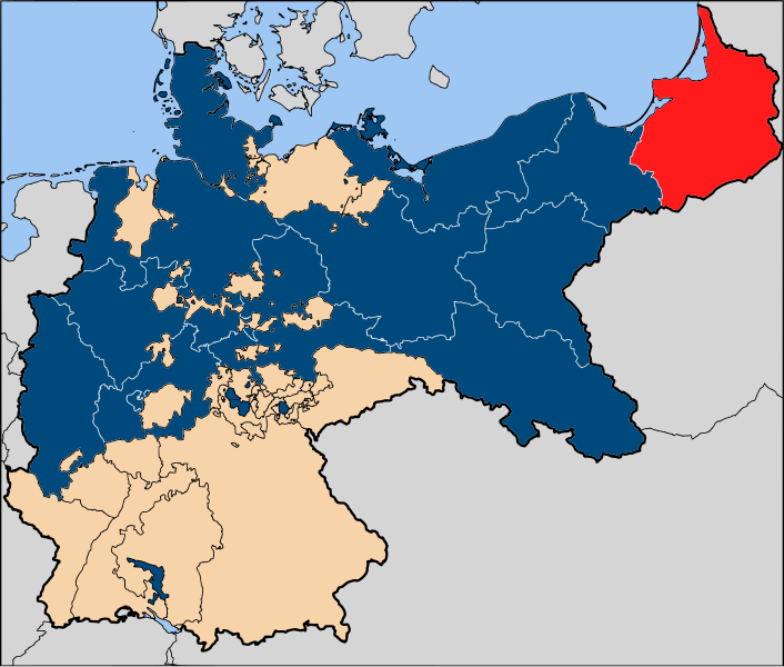
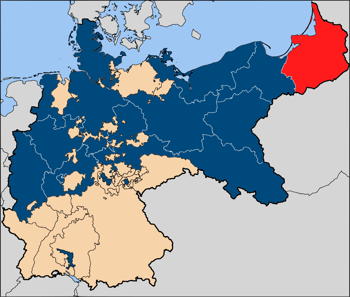
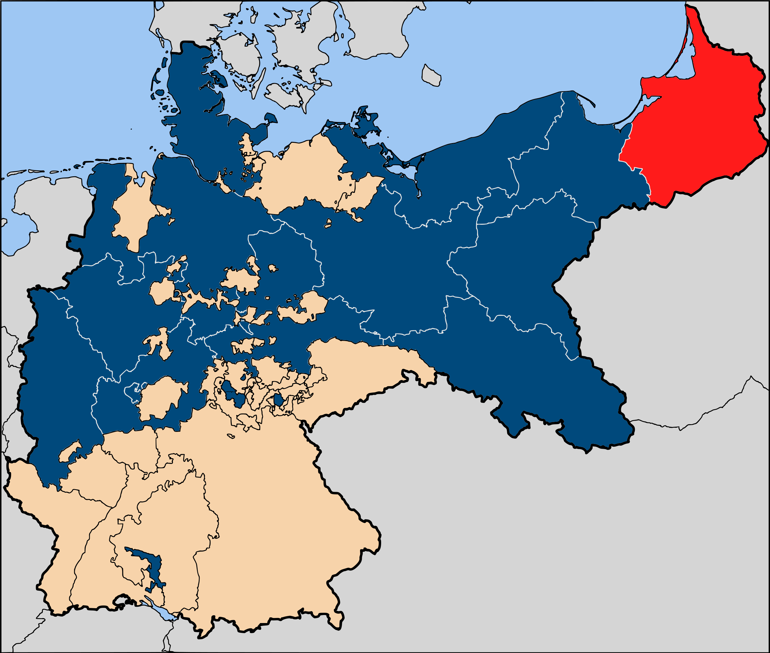
| Beschreibung | The province of East Prussia (red), within the Kingdom of Prussia (blue). |
| Datum | |
| Quelle | Based on map data of the IEG-Maps project (Andreas Kunz, B. Johnen and Joachim Robert Moeschl: University of Mainz) - http://www.ieg-maps.uni-mainz.de |
| Urheber | User:52 Pickup |
| Genehmigung (Weiternutzung dieser Datei) |
Diese Datei ist unter der Creative-Commons-Lizenz „Namensnennung – Weitergabe unter gleichen Bedingungen 2.5 generisch“ (US-amerikanisch) lizenziert.
|
Dateiversionen
Klicke auf einen Zeitpunkt, um diese Version zu laden.
| Version vom | Vorschaubild | Maße | Benutzer | Kommentar | |
|---|---|---|---|---|---|
| aktuell | 20:11, 13. Jan. 2007 | | 2.592 × 2.200 (754 KB) | wikimediacommons>52 Pickup | {{Information| |Description=The province of {{link|East Prussia}} (red), within the {{link|Kingdom of Prussia}} (blue). |Source= Based on map data of the IEG-Maps project (Andreas Kunz, B. Johnen and Joachim Robert Moeschl: University of Mainz) - http:// |
Dateiverwendung
Die folgende Seite verwendet diese Datei: